Back to shop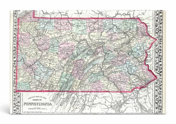
Antique Maps
County Map of the State of Pennsylvania (1874)
$49.99
In stock· SKU MAP085-CAN-SQ-1212-NIC
Manufactured in the USA · ships out in 5–7 days · always free shipping.
MaterialCanvas Wall Art
FormatSquare
Size12" x 12"
1
Highlights
- 1874 Mitchell Map of Pennsylvania — a faithful canvas reproduction of an authentic antique map.
- CHOOSE YOUR SIZE & FORMAT: Pick your dimensions and shape right from this listing — vertical, horizontal, panoramic and square options available.
- MUSEUM-QUALITY GICLEE: Fade-resistant archival inks on premium artist-grade canvas, hand-stretched and gallery-wrapped over a solid 1.5" wood frame, hardware attached and ready to hang.
- A REFINED FOCAL POINT for the living room, bedroom, study, home office or entryway — timeless style with lasting appeal.
- HANDCRAFTED IN THE USA: Made to order in multiple sizes and shapes — a thoughtful, gallery-worthy gift.
Description
This hand-colored 1874 Mitchell engraved map depicts Pennsylvania's county boundaries in soft pastel hues of pink, green, teal, and yellow, bordered by an ornate floral and vine decorative frame. Pennsylvania, the Keystone State, is shown with its characteristic diagonal ridge-and-valley topography running southwest to northeast, with county names, towns, rivers, and roads meticulously labeled throughout. The map captures the state at a pivotal post-Civil War moment in its history, making it a historically rich piece for collectors and lovers of American cartographic art.