Antique Maps
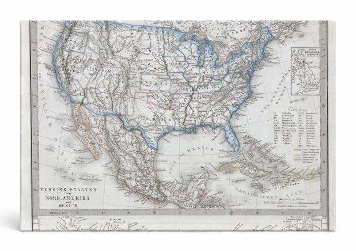
1862 Stieler Map of the United States and Mexico
$49.99
MaterialCanvas Wall Art
FormatSquare
Size12" x 12"
Highlights
- 1862 Stieler Map of the United States — a faithful canvas reproduction of an authentic antique map.
- CHOOSE YOUR SIZE & FORMAT: Pick your dimensions and shape right from this listing — vertical, horizontal, panoramic and square options available.
- MUSEUM-QUALITY GICLEE: Fade-resistant archival inks on premium artist-grade canvas, hand-stretched and gallery-wrapped over a solid 1.5" wood frame, hardware attached and ready to hang.
- A REFINED FOCAL POINT for the living room, bedroom, study, home office or entryway — timeless style with lasting appeal.
- HANDCRAFTED IN THE USA: Made to order in multiple sizes and shapes — a thoughtful, gallery-worthy gift.
Description
This beautifully detailed 1862 engraved map, titled 'Vereins-Staaten von Nord-Amerika und Mexico' (United States of North America and Mexico), depicts the continental United States, Mexico, Central America, and the Caribbean with hand-applied color highlights indicating political boundaries, rivers, and topography. Published by the renowned Justus Perthes cartographic house in Gotha, Germany — one of the most respected geographic publishers of the 19th century — the map reflects the era of the American Civil War, showing a nation whose western territories were still being defined. Subtle pastel washes of blue, orange, and red delineate states and territories against an aged cream background, lending the piece an elegant, scholarly character suited to a study, library, or map-lover's collection.