Back to shop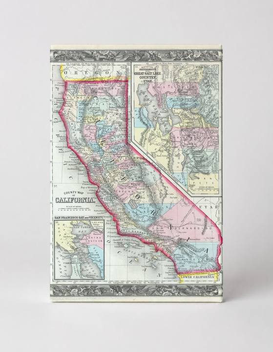
Antique Maps
County Map of California (1860)
$49.99
In stock· SKU MAP066-CAN-SQ-1212-NIC
Manufactured in the USA · ships out in 5–7 days · always free shipping.
MaterialCanvas Wall Art
FormatSquare
Size12" x 12"
1
Highlights
- 1860 Mitchell's Map of California — a faithful canvas reproduction of an authentic antique map.
- CHOOSE YOUR SIZE & FORMAT: Pick your dimensions and shape right from this listing — vertical, horizontal, panoramic and square options available.
- MUSEUM-QUALITY GICLEE: Fade-resistant archival inks on premium artist-grade canvas, hand-stretched and gallery-wrapped over a solid 1.5" wood frame, hardware attached and ready to hang.
- A REFINED FOCAL POINT for the living room, bedroom, study, home office or entryway — timeless style with lasting appeal.
- HANDCRAFTED IN THE USA: Made to order in multiple sizes and shapes — a thoughtful, gallery-worthy gift.
Description
This richly detailed 1860 Mitchell's County Map of California presents the state in hand-colored engraving style, with counties delineated in pastel pink, yellow, green, and blue, bordered by an ornate decorative frame. Inset maps include San Francisco Bay and Vicinity — showcasing the bay that would become one of the most iconic natural harbors on the West Coast — as well as a detailed rendering of the Great Salt Lake Country of Utah. Published by Samuel Augustus Mitchell Jr., this map captures California just a decade after the Gold Rush transformed it into a booming U.S. state, making it a compelling piece of American cartographic history.