Antique Maps
Planisphère (1857)
$49.99
MaterialCanvas Wall Art
FormatSquare
Size12" x 12"
Highlights
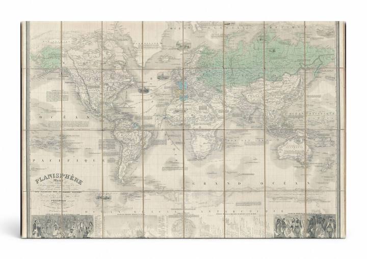
- 1857 Vuillemin Case Map of the World on Mercator's Projection — a faithful canvas reproduction of an authentic antique map.
- CHOOSE YOUR SIZE & FORMAT: Pick your dimensions and shape right from this listing — vertical, horizontal, panoramic and square options available.
- MUSEUM-QUALITY GICLEE: Fade-resistant archival inks on premium artist-grade canvas, hand-stretched and gallery-wrapped over a solid 1.5" wood frame, hardware attached and ready to hang.
- A REFINED FOCAL POINT for the living room, bedroom, study, home office or entryway — timeless style with lasting appeal.
- HANDCRAFTED IN THE USA: Made to order in multiple sizes and shapes — a thoughtful, gallery-worthy gift.
Description
This striking 1857 world map by Alexandre Vuillemin presents the entire globe rendered in Mercator's Projection, with hand-applied color distinguishing continents and territorial borders across a warm aged-paper palette of cream, sage green, and soft gray. The map features decorative vignettes along the lower border depicting peoples and scenes from various world regions, adding an ethnographic dimension characteristic of mid-19th century French cartography. Published in Paris, this planisphere captures the geopolitical knowledge of its era — including colonial boundaries, ocean names labeled in French such as 'Grand Océan' and 'Océan Pacifique' — making it both a scholarly artifact and an elegant decorative piece for any study or library.