Back to shop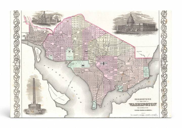
Antique Maps
Georgetown and the City of Washington D.C. (1855)
$49.99
In stock· SKU MAP060-CAN-SQ-1212-NIC
Manufactured in the USA · ships out in 5–7 days · always free shipping.
MaterialCanvas Wall Art
FormatSquare
Size12" x 12"
1
Highlights
- 1855 Colton Plan or Map of Washington D.C. — a faithful canvas reproduction of an authentic antique map.
- CHOOSE YOUR SIZE & FORMAT: Pick your dimensions and shape right from this listing — vertical, horizontal, panoramic and square options available.
- MUSEUM-QUALITY GICLEE: Fade-resistant archival inks on premium artist-grade canvas, hand-stretched and gallery-wrapped over a solid 1.5" wood frame, hardware attached and ready to hang.
- A REFINED FOCAL POINT for the living room, bedroom, study, home office or entryway — timeless style with lasting appeal.
- HANDCRAFTED IN THE USA: Made to order in multiple sizes and shapes — a thoughtful, gallery-worthy gift.
Description
This vivid 1855 Colton map depicts the city of Washington, D.C. — the capital of the United States — and the adjacent city of Georgetown, rendered in hand-colored pink, green, and cream with a detailed street grid, diagonal avenues, and the Potomac River along its southern edge. Decorative vignettes in the corners illustrate iconic landmarks of the era, including the U.S. Capitol Building and the Washington Monument, then still under construction. The ornate floral border and period cartouche lend the piece a refined antique character suited to history-minded and map-lover décor.