Back to shop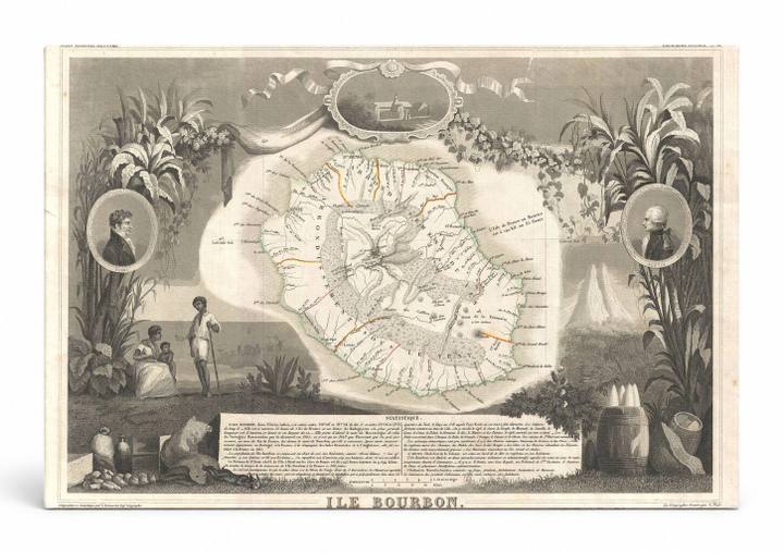
Antique Maps
Ile Bourbon (Réunion) Map (1852)
$49.99
In stock· SKU MAP054-CAN-SQ-1212-NIC
Manufactured in the USA · ships out in 5–7 days · always free shipping.
MaterialCanvas Wall Art
FormatSquare
Size12" x 12"
1
Highlights
- 1852 Levasseur Map of the Reunion or the Ile. Bourbon, Indian Ocean — a faithful canvas reproduction of an authentic antique map.
- CHOOSE YOUR SIZE & FORMAT: Pick your dimensions and shape right from this listing — vertical, horizontal, panoramic and square options available.
- MUSEUM-QUALITY GICLEE: Fade-resistant archival inks on premium artist-grade canvas, hand-stretched and gallery-wrapped over a solid 1.5" wood frame, hardware attached and ready to hang.
- A REFINED FOCAL POINT for the living room, bedroom, study, home office or entryway — timeless style with lasting appeal.
- HANDCRAFTED IN THE USA: Made to order in multiple sizes and shapes — a thoughtful, gallery-worthy gift.
Description
This ornate 1852 engraved map by Victor Levasseur depicts Île Bourbon — the historical French colonial name for Réunion, a volcanic island in the Indian Ocean east of Madagascar — surrounded by elaborate decorative vignettes featuring tropical sugar cane plants, portrait medallions of notable figures, and a scene of local inhabitants. The map shows the island's interior mountain ranges, coastal settlements, and road network with delicate hand-applied color highlights on select routes. Réunion, a French overseas territory, is known for the active Piton de la Fournaise volcano and its role as a major sugar-producing colony in the 19th century.