Back to shop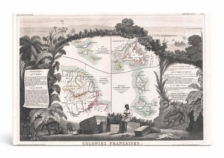
Antique Maps
Colonies Françaises en Amérique (1852)
$49.99
In stock· SKU MAP034-CAN-SQ-1212-NIC
Manufactured in the USA · ships out in 5–7 days · always free shipping.
MaterialCanvas Wall Art
FormatSquare
Size12" x 12"
1
Highlights
- 1852 Levasseur Map of Guyana, Miquelon, Newfoundland, and St. Martin — a faithful canvas reproduction of an authentic antique map.
- CHOOSE YOUR SIZE & FORMAT: Pick your dimensions and shape right from this listing — vertical, horizontal, panoramic and square options available.
- MUSEUM-QUALITY GICLEE: Fade-resistant archival inks on premium artist-grade canvas, hand-stretched and gallery-wrapped over a solid 1.5" wood frame, hardware attached and ready to hang.
- A REFINED FOCAL POINT for the living room, bedroom, study, home office or entryway — timeless style with lasting appeal.
- HANDCRAFTED IN THE USA: Made to order in multiple sizes and shapes — a thoughtful, gallery-worthy gift.
Description
This richly detailed 1852 engraved map by French cartographer Levasseur depicts the French colonies in the Americas, featuring inset maps of French Guiana (Guyane Française) on the South American mainland, the islands of Saint-Pierre and Miquelon off the coast of Newfoundland, Canada, and Saint-Martin in the Caribbean. The composition is framed by an elaborate decorative border of tropical vegetation, exotic wildlife, and a seated indigenous figure, reflecting the 19th-century taste for ornamental cartography. Statistical tables and descriptive text panels accompany the maps, making this both a geographical document and a striking work of illustrative art.