Back to shop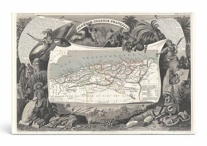
Antique Maps
Algérie Colonie Française (1852)
$49.99
In stock· SKU MAP032-CAN-SQ-1212-NIC
Manufactured in the USA · ships out in 5–7 days · always free shipping.
MaterialCanvas Wall Art
FormatSquare
Size12" x 12"
1
Highlights
- 1852 Levasseur Map of Algeria — a faithful canvas reproduction of an authentic antique map.
- CHOOSE YOUR SIZE & FORMAT: Pick your dimensions and shape right from this listing — vertical, horizontal, panoramic and square options available.
- MUSEUM-QUALITY GICLEE: Fade-resistant archival inks on premium artist-grade canvas, hand-stretched and gallery-wrapped over a solid 1.5" wood frame, hardware attached and ready to hang.
- A REFINED FOCAL POINT for the living room, bedroom, study, home office or entryway — timeless style with lasting appeal.
- HANDCRAFTED IN THE USA: Made to order in multiple sizes and shapes — a thoughtful, gallery-worthy gift.
Description
This ornate 1852 engraved map by Victor Levasseur depicts Algeria — titled 'Algérie Colonie Française' — during the period of French colonial rule, which began with the French conquest of Algiers in 1830. The central cartographic panel shows the North African coastline along the Mediterranean Sea, with regional divisions, roads, and place names rendered in fine detail. Elaborate allegorical vignettes frame the map on all sides, featuring figures in regional dress, exotic flora, and symbolic imagery characteristic of 19th-century French decorative cartography.