Antique Maps
United States Map (1851)
$49.99
MaterialCanvas Wall Art
FormatSquare
Size12" x 12"
Highlights
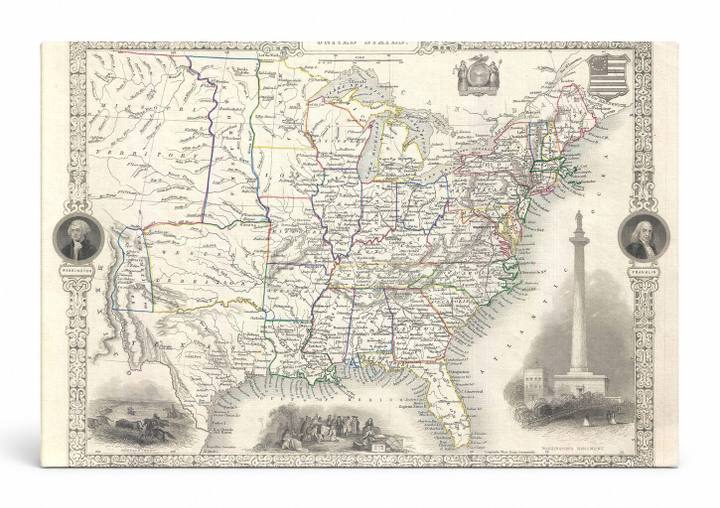
- 1851 Tallis and Rapkin Map of the United States — a faithful canvas reproduction of an authentic antique map.
- CHOOSE YOUR SIZE & FORMAT: Pick your dimensions and shape right from this listing — vertical, horizontal, panoramic and square options available.
- MUSEUM-QUALITY GICLEE: Fade-resistant archival inks on premium artist-grade canvas, hand-stretched and gallery-wrapped over a solid 1.5" wood frame, hardware attached and ready to hang.
- A REFINED FOCAL POINT for the living room, bedroom, study, home office or entryway — timeless style with lasting appeal.
- HANDCRAFTED IN THE USA: Made to order in multiple sizes and shapes — a thoughtful, gallery-worthy gift.
Description
This beautifully detailed 1851 antique engraved map of the United States by John Tallis and John Rapkin presents the nation in delicate hand-colored cartographic style, showing state boundaries, cities, rivers, and early railroad routes across the continent. Decorative vignettes frame the composition, featuring portraits of George Washington and Benjamin Franklin, an illustration of a Native American encampment, a frontier buffalo hunt scene, and a rendering of the Washington Monument under construction in Washington, D.C. — the capital city that had been established on the Potomac River in 1800. The ornate floral border and heraldic emblems give this piece the refined, scholarly character of Victorian-era cartography, making it an elegant statement piece for a study, library, or office.