Antique Maps
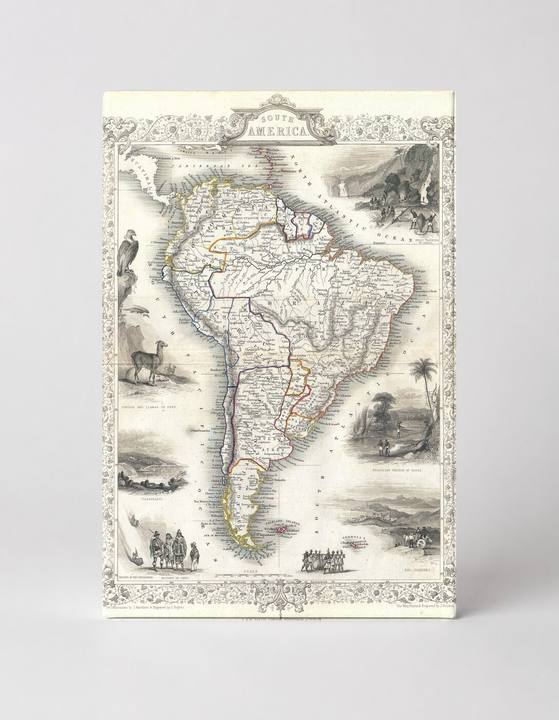
South America (1850)
$49.99
MaterialCanvas Wall Art
FormatSquare
Size12" x 12"
Highlights
- 1850 Tallis Map of South America — a faithful canvas reproduction of an authentic antique map.
- CHOOSE YOUR SIZE & FORMAT: Pick your dimensions and shape right from this listing — vertical, horizontal, panoramic and square options available.
- MUSEUM-QUALITY GICLEE: Fade-resistant archival inks on premium artist-grade canvas, hand-stretched and gallery-wrapped over a solid 1.5" wood frame, hardware attached and ready to hang.
- A REFINED FOCAL POINT for the living room, bedroom, study, home office or entryway — timeless style with lasting appeal.
- HANDCRAFTED IN THE USA: Made to order in multiple sizes and shapes — a thoughtful, gallery-worthy gift.
Description
This richly detailed 1850 Tallis engraved map of South America presents the entire continent with hand-colored borders delineating nations, surrounded by ornate vignette illustrations of regional wildlife, indigenous peoples, and landscapes — including an Andean condor, llamas, and tropical scenes. Published by John Tallis & Company, the map captures South America during a pivotal era of post-colonial nation-building, showing countries such as Brazil, Argentina, Peru, and Chile with their mid-19th-century boundaries. Decorative cartouche lettering, a lace-like border, and inset scenic panels give this piece the character of a fine Victorian parlor map, blending geographic information with pictorial storytelling.