Back to shop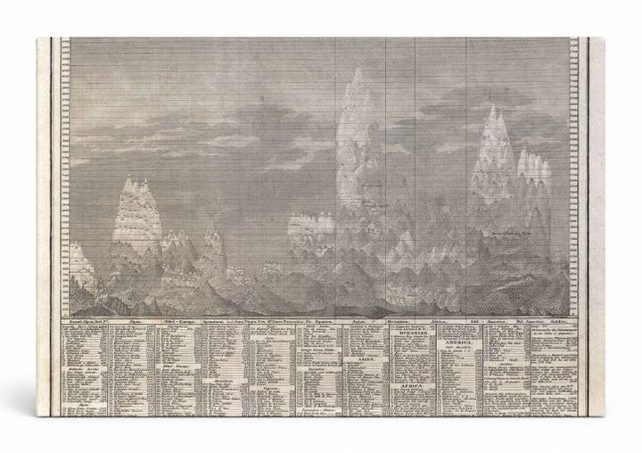
Antique Maps
Vergleichende Übersicht bekannter Höhen und Orte der Erde über der Meeres-Fläche (1850)
$49.99
In stock· SKU MAP023-CAN-SQ-1212-NIC
Manufactured in the USA · ships out in 5–7 days · always free shipping.
MaterialCanvas Wall Art
FormatSquare
Size12" x 12"
1
Highlights
- 1850 Meyer Comparative Chart of World Mountains — a faithful canvas reproduction of an authentic antique map.
- CHOOSE YOUR SIZE & FORMAT: Pick your dimensions and shape right from this listing — vertical, horizontal, panoramic and square options available.
- MUSEUM-QUALITY GICLEE: Fade-resistant archival inks on premium artist-grade canvas, hand-stretched and gallery-wrapped over a solid 1.5" wood frame, hardware attached and ready to hang.
- A REFINED FOCAL POINT for the living room, bedroom, study, home office or entryway — timeless style with lasting appeal.
- HANDCRAFTED IN THE USA: Made to order in multiple sizes and shapes — a thoughtful, gallery-worthy gift.
Description
This 1850 Meyer comparative mountain chart presents a dramatic panoramic engraving depicting the relative heights of the world's most notable peaks across Europe, Asia, Africa, and the Americas, all labeled in German. Published by the Geographisches Institut in Hildburghausen, Germany, the chart was part of Meyer's celebrated geographical atlas series and reflects the era's scientific ambition to visually classify and compare the natural world. Detailed columnar data tables below the mountain silhouettes list elevations and notable landmarks, making this both a scientific document and a striking work of graphic art.