Back to shop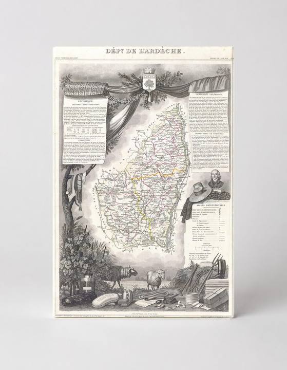
Antique Maps
Dept. de L'Ardèche, France (1847)
$49.99
In stock· SKU MAP017-CAN-SQ-1212-NIC
Manufactured in the USA · ships out in 5–7 days · always free shipping.
MaterialCanvas Wall Art
FormatSquare
Size12" x 12"
1
Highlights
- 1847 Levasseur Map of the Dept. de L'Ardeche, France — a faithful canvas reproduction of an authentic antique map.
- CHOOSE YOUR SIZE & FORMAT: Pick your dimensions and shape right from this listing — vertical, horizontal, panoramic and square options available.
- MUSEUM-QUALITY GICLEE: Fade-resistant archival inks on premium artist-grade canvas, hand-stretched and gallery-wrapped over a solid 1.5" wood frame, hardware attached and ready to hang.
- A REFINED FOCAL POINT for the living room, bedroom, study, home office or entryway — timeless style with lasting appeal.
- HANDCRAFTED IN THE USA: Made to order in multiple sizes and shapes — a thoughtful, gallery-worthy gift.
Description
This finely detailed 1847 engraved map by Victor Levasseur depicts the Ardèche department in the Auvergne-Rhône-Alpes region of southeastern France, bordered to the east by the Rhône River. The map is richly embellished with decorative vignettes including local flora, fauna, agricultural produce, a portrait medallion, a coat of arms, and bilingual statistical text panels — all characteristic of Levasseur's celebrated 'Atlas National Illustré' series. Ardèche is renowned for its dramatic gorges, chestnut forests, and the winding Ardèche River, all of which lend the region the pastoral and rugged character reflected in the map's ornamental borders.