Antique Maps
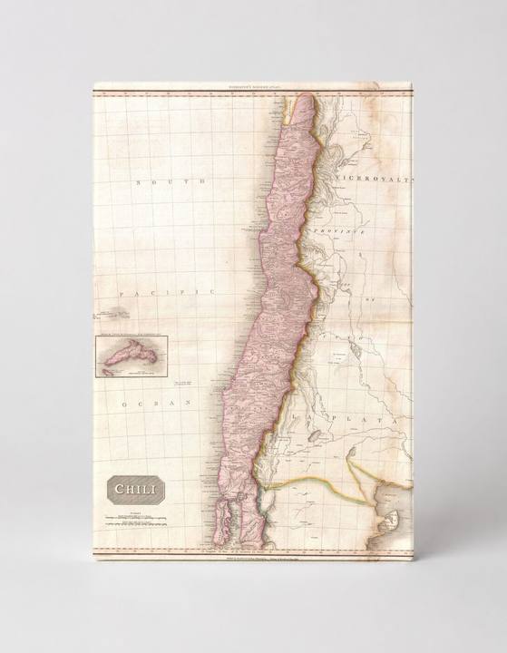
Pinkerton Map of Chile (1818)
$49.99
MaterialCanvas Wall Art
FormatSquare
Size12" x 12"
Highlights
- 1818 Pinkerton Map of Chile — a faithful canvas reproduction of an authentic antique map.
- CHOOSE YOUR SIZE & FORMAT: Pick your dimensions and shape right from this listing — vertical, horizontal, panoramic and square options available.
- MUSEUM-QUALITY GICLEE: Fade-resistant archival inks on premium artist-grade canvas, hand-stretched and gallery-wrapped over a solid 1.5" wood frame, hardware attached and ready to hang.
- A REFINED FOCAL POINT for the living room, bedroom, study, home office or entryway — timeless style with lasting appeal.
- HANDCRAFTED IN THE USA: Made to order in multiple sizes and shapes — a thoughtful, gallery-worthy gift.
Description
This antique 1818 engraved map by John Pinkerton depicts Chile as a long, narrow strip of territory running along the western coast of South America, rendered in soft pink wash with hand-applied color highlighting regional boundaries, mountain ranges, and coastal features. The South Pacific Ocean dominates the left portion of the composition, and a small inset in the lower left shows the Juan Fernández Islands, the remote Chilean archipelago famous as the inspiration for Robinson Crusoe. Chile, which stretches over 2,600 miles along the Pacific coast of South America, was on the eve of independence when this map was produced, making it a historically significant cartographic document of the region.