Nice Designs
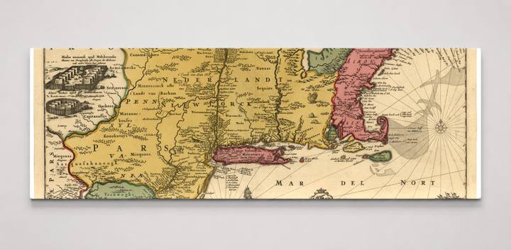
Novi Belgii Novaeque Angliae - nec non partis Virginiae tabula multis in locis emendata LOC 97683561
$159.99
FormatPanoramic
Size6" x 20"
Highlights
- Premium canvas print of Novi Belgii Novaeque Angliae - nec non partis Virginiae tabula multis in locis emendata LOC 97683561
- Hand-stretched 1.5" gallery wrap canvas — arrives ready to hang, no frame needed
- Fade-resistant inks for long-lasting color and rich tones, made to order
- Made to order in the United States by niceandco.
- Finished size 60" W x 20" H
Description
This richly hand-colored antique engraved map depicts the northeastern coast of North America, encompassing New Netherland (Nova Belgica), New England, and Virginia as understood by European cartographers in the late 17th century. The map labels regions such as Nova Belgica, Nova Francia, and Pennsylvania alongside the 'Mar Del Nort' (Atlantic Ocean), and features a decorative cartouche at lower center with a panoramic view of New Amsterdam — the Dutch colonial settlement on Manhattan Island that would later become New York City. Decorative figures, sea creatures, and vignettes of Indigenous peoples and settlements add historical and ethnographic detail characteristic of Dutch Golden Age cartography.